
In Search of Claude
In August 2001, Art and Denise Denomme set out to "find Claude", not the man Claude, but rather ... his land.
Claude was the first descendant of the Denomme
family to arrive in North America. He landed in Quebec City in 1664.
In
early 1665 he obtained a piece of land on Île d'Orléans,
an island south east of Quebec City.
For some time, Art had a map of the island which showed the approximate
location of Claude's lands. It was located on the south west side of
the
island, in St. Laurent parish (St. Paul in Claude's time). The land was
2 arpents in width and went from the shore of the St. Lawrence River
to
the centre of the island. An arpent is equal to 191.82 ft. or 58.47 meters,
making Claude's land 117 metres (383 ft) wide by approximately 3 km.
(2
miles) in depth. The map Art had, however, was not accurate enough to
get any closer than 1 km., give or take.
When Art and Denise visited Île d'Orléans
they immediately drove to Ste. Famille, where there is a Genealogy Centre
for the Island. The database at the centre was not able to give them the
current location of Claude's land. From the Genealogy Centre Art purchased
two maps of the island, the 1689 map produced by Villeneuve and the 1709
map produced by Decouagne. They drove a little further down the road to
a shop called "Centre de documentation et de genealogie de Île
d'Orléans" located at 3953 chemin Royal, Ste. Famille. There
Art purchased a short history of the land originally settled by Claude
Desttous (?) / Claude Delaunay. It provided Art and Denise with a history
of the land from 1665 when Claude obtained it, to 1725 when Louis Lemelin
(Claude's son in law) owned it, and more importantly, also provided a
current address, as provided by the Municipalite de St. Laurent. They
drove past the address but did not stop.
That night, back in Quebec City, Art laid out the two maps he had purchased,
took out a ruler and calculator and started measuring and calculating
the possible location of the land based on the St. Laurent church and
the Riviere a Maheu.
Art's calculations per the Villeneuve
map positioned Claude's land as being 1.85 km. from the St. Laurent church
and 3.89 km. to the river. Art then rechecked his calculations using the
1709 map. To complicate matters, the 1709 map is measured in arpents.
Three more measurements and calculations confirmed the distance exactly.
 The
next day they drove to the church in St. Laurent, checked the odometer
and started east and kept driving until they had driven 1.85 km. They
stopped in front of 1082 chemin Royal and the address matched perfectly
with the one provided the previous day at the shop in Ste. Famille. We
had found Claude's land!
The
next day they drove to the church in St. Laurent, checked the odometer
and started east and kept driving until they had driven 1.85 km. They
stopped in front of 1082 chemin Royal and the address matched perfectly
with the one provided the previous day at the shop in Ste. Famille. We
had found Claude's land!
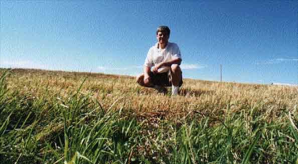
You can hardly see the house from the road. The house is located about 200-300 ft from the road on a ridge that is about 30 ft higher than the road behind a row of trees. Art and Denise drove up the driveway to discover one of the older homes in that area of Île d'Orléans.
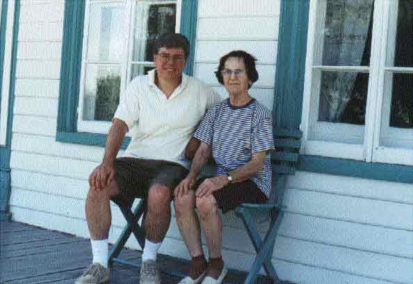
The current owner of the land is Gisèle Lachance. She showed Art and Denise around the house which is a little over 250 years old. It includes a root cellar that her father told her was over 300 years old, not old enough to be built by Claude, but very likely Louis Lemelin, his son in law, who took over the land in the 1690's and still owned it in 1725.
 Gisèle's
land is 200' x 1000'. Her home was very likely built in the same location
of Louis Lemelin's. The 1789 "Carte de Villeneuve" (map) records
that Claude only had a "cabine et grange" which would have been
very small small wooden cabin and a stable. The rest of Claude's land,
immediately to the east of Gisèle, is being farmed by her nephew,
who is also a Lachance. The entire piece of land was purchased by Gisèle's
grandfather for her father in the early 1900's. When her father died,
Gisèle got the land the old home was on, and her brother got the
rest of the land to farm. His portion has since passed to his son.
Gisèle's
land is 200' x 1000'. Her home was very likely built in the same location
of Louis Lemelin's. The 1789 "Carte de Villeneuve" (map) records
that Claude only had a "cabine et grange" which would have been
very small small wooden cabin and a stable. The rest of Claude's land,
immediately to the east of Gisèle, is being farmed by her nephew,
who is also a Lachance. The entire piece of land was purchased by Gisèle's
grandfather for her father in the early 1900's. When her father died,
Gisèle got the land the old home was on, and her brother got the
rest of the land to farm. His portion has since passed to his son.
What happened to the land between 1725 and 1900 would be interesting
research for someone.
![]()